/ TV, video, photo and audio gear / TV and video / Satellite TV / Drone Deploy Aerial 3D Mapping Software - Brand...

Miscellaneous
used
Drone Deploy Aerial 3D Mapping Software - Brand New, Ikeja
Price5 200 000 ₦
Region:
Lagos State / Ikeja
Updated:
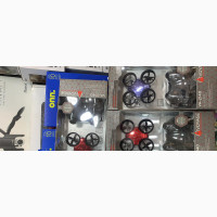
Drone Deploy Aerial 3D Mapping Software is perfect for businesses in various industries such as agriculture, construction, mining, inspection, and more. With this software, you can easily extract complete visual data for any site or building, regardless of angle or altitude. It offers features like image management, map sharing, color coding, geocoding, and spatial analysis. You can also create 3D imagery, export images, and even integrate census data. This software is a must-have for any business that needs accurate and detailed mapping.
|
Author, contacts | |
Avena Technologies / feedback, info. / user activity validation | |
|
Phone number:
0803xxxxxx
show
| |
Ad ID: #49519
(added by an unregistered user, Registration date: 30-05-2023)
Added / Updated: 22-04-2025 09:34
(valid until: 19-10-2025)
A fixed ad address:
Viewed today: ?, Views in total: ?
Similar ads
There are quite a few appealing options among these...
